EchoRFID Products
EchoRFID Products
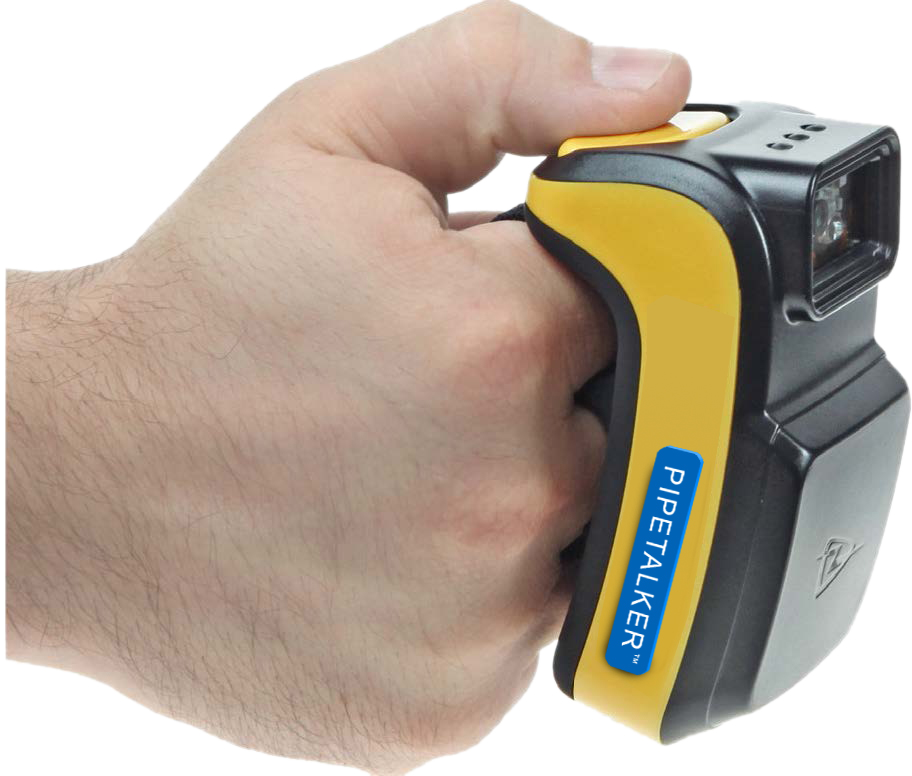
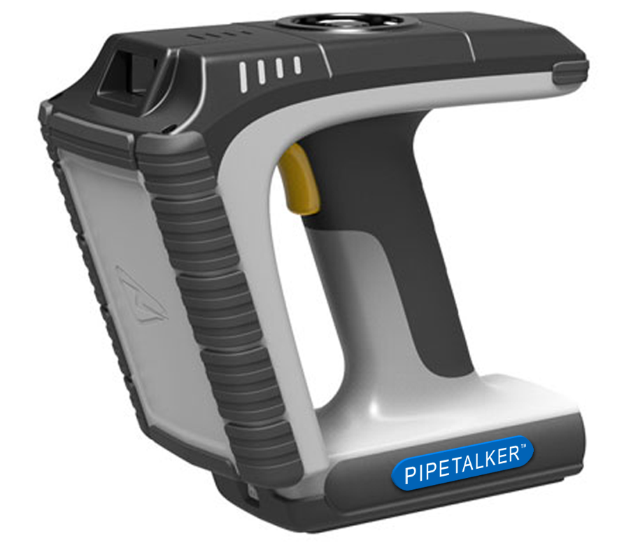
PIPETALKER™
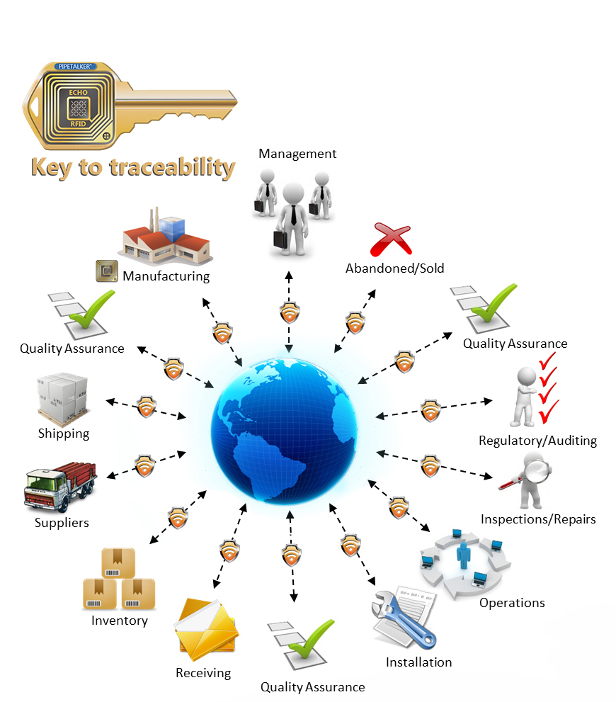
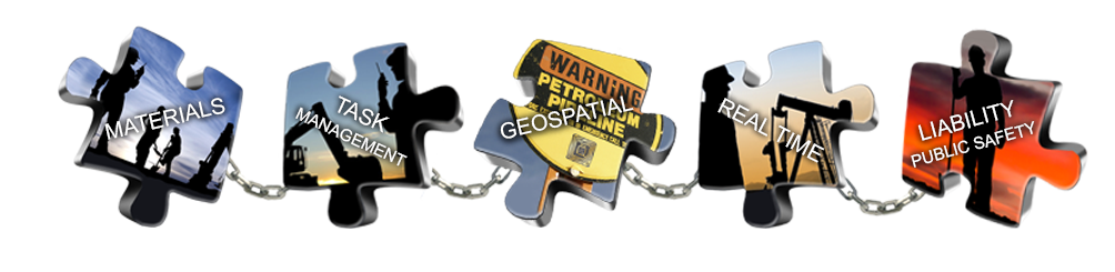
Our Flagship product PIPETALKER™ is a menu-driven software tool that runs on both office and portable hand-held field-friendly devices such as smart phones and tablets. Its open architecture can integrate with a company's existing GIS system or take advantage of cloud computing scales. It uses GPS, RFID, and other hardware tools to track asset attributes; the program documents construction, maintenance and operational inspections and quality control. It uses military-grade security protocols for data access while defeating natural silos of information. It is designed for both compliance and audit requirements, and for operational efficiencies.
PIPETALKER elevates PIM to an extremely high level of documentation competency. As well, field performance and actions would no longer be obscure and lack transparency. The system will have a beneficial impact to company assets by providing an audit of every action that would be backed up by photos, video and voice recordings. There are as well, many tools for company employees to use that will enhance safety, time management, organization, cost, and progress reporting. All tangible data is linked to the asset’s pipe number, material and weld number, QC segments, GPS etc.
With a link to modern technology such as secure cloud data systems, RFID, smart phones and tablets, the PIPETALKER system enables the underground system to talk to us in real time as we approach its physical location.
TSL-1153 TSL-1166

How it Works
The PIPETALKER system achieves unprecedented accuracy in precise position awareness and asset metadata through the application of its proprietary and patented processes incorporating RFID, GPS, and data management services. Integrating RFID tags on or near underground assets is accomplished by designating the RFID chip as a collected feature. Utilizing a data collection system functionality, the X, Y and Z coordinates of the RFID tag and required meta-data of the asset are collected at the time that the RFID tag is placed in the ground. The RFID chip location including depth is updated in the field with the X, Y and Z coordinates and meta-data collected by the field data collection software. This is then loaded to the database via real - time software and telecommunications interface. Finding and interrogating the RFID tag - The data management system and GPS coordinates can be utilized to find the optimal surface location above a buried RFID tag needed to facilitate the interrogation of the tag. Location Data that is broadcast from the interrogated RFID tag is integrated into the data management system.

RFID
 The term RFID refers to radio frequency identification and is used to describe various technologies that use radio waves to automatically identify objects. RFID technology is similar to the bar code identification systems we see in retail stores every day; however one big difference between RFID and bar code technology is that RFID does not rely on the line-of-sight reading that bar code scanning requires to work. An RFID system consists of an antenna and a transceiver which read the radio frequency and transfers the information to a processing device and a transponder, or RF tag, which contains the RF circuitry and information to be transmitted. The antenna provides the means for the integrated circuit to transmit its information to the reader that converts the radio waves reflected back from the RFID tag into digital information that can then be passed on to computers that can analyze the data. In RFID systems, the tags that hold the data are broken down into two different types. Passive tags use the radio frequency from the reader to transmit their signal. Active tags are much more sophisticated and have on-board battery for power to transmit their data signal over a greater distance and power random access memory (RAM) giving them the ability to store up to 32,000 bytes of data. RFID systems can be used just about anywhere that a unique identification system is needed. The tag can carry information as simple as a utility owners name and date of installation to complex instructions on whom and how the utility was manufactured. RFID is said by many in the industry to be the frontrunner technology for location identification and data collection.

GPS
The term GPS refers to a Global Positioning System. The EchoRFID solution is both RFID and GPS driven. The RFID Technology integrates with widely utilized and accepted GPS receiver hardware. The tags make use of all data present in the GPS receiver's data stream to establish, in real-time, the accuracy of each position acquisition (fix) as it is received from the GPS unit. Since system accuracies, area coverage and availability are predicated upon these GPS equipment customer choices. Clients can match the level of GPS receiver performance to the tag's location awareness accuracy requirements.

Data Management System
EchoRFID's solution utilizes a data management services platform built to support RFID and GPS technologies. This means RFID and GPS locations are processed and maintained to the highest standard of accuracy. The data management process is implemented on a robust, secure, business-rules based, high-performance database. The data base manages the full life cycle of asset data collection and management, from initial project specification through data location, data certification and subsequent damage prevention operations. The data base manages RFID and GPS which include all previously collected and compiled data relevant to the precise buried \ surface locations of the tags. The database is designed to service multiple, simultaneous users through secure network links through a Project View. This can occur in real-time, as data is gathered and the tags are installed in the field. The system provides secure data services to authenticated users over a data network that may include wireless and cellular technologies. The data repository accepts RFID using GPS and can integrate and display these points to appropriate levels of accuracy and resolution. The tag is matched to the coordinate system in use at the local project site and uploaded to the data repository. The information is immediately available in digital format for use with other applications, including CAD systems and GIS. The information is now online for data collection in the field as well as providing the operator with accurate position awareness. Since registration and control points have previously been established, any newly collected data can be appended to the tag as well.
PIM Work Unit Modules and Mobile Technology
There are thirteen patented modules that cover the integrity management process from cradle to grave. The modules are what sets the EchoStar PIPETALKER system apart from anything on the market today.
Each module consists of work units that comprise of questions and dropdown menus to choose the answer from, or a place to enter data, for each step in the construction, inspection, repair, maintenance, and abandonment process. Each step may be videoed, photographed, or orally recorded and is automatically tagged to the RFID tag or GPS location.
Once a work unit is opened, it cannot be closed until all the questions are addressed. In example, if a weld is rejected, it cannot be closed until the repair has been made. Open work units are flagged. Once a module has been closed, you have just created an audit record that can be recalled anywhere any time.
Another significant outcome from PIPETALKER is that third party vendors such as a land agent can use the crossing and landowner sections so that field personnel have the latest information the minute the land agent has it. This type of information is always critical to have as soon as possible especially for pipeline crossings.
Each PIPETALKER work unit has a risk rating system from 1 to 3 that keeps personnel aware of the dangers they may encounter while completing a task. As well there are safety questions that are critical to the task.
The PIPETALKER offers so much for so little, a company really cannot afford to not have it.